Sunday, November 9, 2008

Two Toonies per boat Please...

Black Bay was crossed in two sections, first to a small island for a snack and then over to the other side, where had the sun been setting we would have been in the shadow of the giant. We continued down the coastline, trying to decipher whether or not we would be able to make it to Pie Island (an area which held some slight anxiety due to others’ accounts which we read about). As the afternoon would progress we would not press on to Pie Island, but layover in Silver Islet to acquire some needed sustenance and as luck would have it, they also had ice cream. Something, when you are on trail is seldom smart to pass up.

After enjoying the said creamed ice we would make our mandatory donation to the Silver Bay Islet harbour. You see the town of silver islet exists for people boaters by boaters, provided they are mostly Canadian. As luck would have it, when we arrived to this shack-orific community hanging on the east shore of the Sibley peninsula, a large blue building reading the word ‘STORE’ hailed to solve all our future pangs of hunger. However while inside this provider of overpriced calories we would learn that it cost a whopping TWO toonies (roughly four dollars from the states of united unison) to use the boat launch-, as two other kayakers happened to enter the store and attempt to pay there. These fellow Canadians would not end up paying sufficient coinage, which as luck would have it, draw attention to our presence by one of the ‘Volunteer’ harbour masters. We had not even used the launch, nor were we on it at the time, but as her Majesty’s will would warrant, some guy, we’ll call him Peter hollered down to us as he explored the fee box.

“How’s it going? Is this your car up here? Did you two place your fee in here”
“Uh, fine. Nope not our vehicle. Not yet, we were fixing to break down our larger bills in the store”
“Right, so this isn’t you’re registration?”
“That’s correct it is not”
“Where are you headed?’
“Back to Bayfield Wisconsin.”
“Ah, Bayfield, well if that was your car I would tell you to move it up over there.”
“Yeah, no, not our car, these kayaks are all we have.”
“Say, what have you got, perhaps I could just give you change, then I don’t have to come back to the box later.”
“Uh, well I’ve got a $10 note, so if you’ve a toonie or a couple of loonies we should be set.”
“Yep, I can do that. You see the Ontario Government pledged to allow us to keep all the fees collected from this here launch and put it into restoring the dock out there; so in a sense, we’re all harbour masters.”
“Very well, glad we can be of contribution.”

You know being an honorary harbour master in a foreign country is certainly an honor. However it didn’t negate the fact that, the same government had no qualms restoring a dock on the shores of the lake while simultaneously identifying fifteen areas, prime enough to quarry rocks for road bed (which would utterly destroy the shoreline and deplete water quality, among other negative impacts on the Lake’s shores). There was some sort of mixed message in there. But there is a digression.

We were off from our blue building adventure to paddle down the shale-laced shores of the Sibley Peninsula towards Thunder Cape. The late afternoon hour did not warrant a successful window of time to cross over to Pie Island for desert, thus we settled for a nice niche on the western part of Tee Bay. In that particular location the land becomes topographically inclined to increase your feeling of insignificance in the terrestrial fashion. The forest and rock erupts from the lakeside creating some imminent compound of beauty and fear. Luckily though, this beauteous sight kept our fears at bay the next day when a ‘STRONG WIND WARNING’ kicked up some gnarly nor’ easter (that’s maritime speak for wind from the north east) in excess of 30kts. Needless to say twas a bit of a sitting around day. No matter, you’d have that.

Saturday, November 8, 2008

Braving Black Bay, Searching the Sleeping Giant

Our next jaunt of adventure, if portrayed through instructions via a scavenger hunt may read something like this:
Be ready to paddle like a yo-yo, retracing your previous paddling distance to locate a safe-haven should you need it.
Realize that said safe-haven will keep you further away from where you want to be, so actually head out amidst those surly seas.
Do not pass go, if go was to accomplish the twenty miles you desired to cover. – Whoa where did that Monopoly™ lingo appear?
Brave 4-6 foot seas in a beam wind for an additional rowdy crossing.
Have helmet ripped off boat, but fail to notice for a few minutes.
Admire white floating object in water that resembles a helmet.
Turn around in heavy seas to retrieve noggin protector.
Meander into unknown bay searching for place to camp, which is sheltered from wind.
Not locate a place like that.
Find a potential place with vertical beach style take out.
Hem and haw a slight bit.
Land diligently, and with grace.
Realize this place provides a glimpse into an abundant agate land.
Decide it is such a cool place it would be beneficial to stay an extra day; the extra day would have nothing to do with incorporative weather.

That there happened to be a simple prognosis of our existence, trying at times, but generally more rewarding than not. We moved away from these immense islands boarding the Black Bay Peninsula in search of a famed Sleeping Giant. En route to find this slumbering gargantuan geologic marvel we paddled vigilantly into a headwind for twenty-five miles. Debilitating as it were we continued on through a few isolated islands, past a fishing camp, which contained mismatched cabins mixed with some menacing maritime menagerie. We knew our locale certainly had to be closing in on the famed Edward Island, more so because that is what the map denoted. We paddled across the channel against a 15kt headwind and ducted behind an island to gather our bearings, this enabled us to better speculate as to where a blasted bay would be, one which would allow us a safe camping spot for the evening. Nestled in the bay we neurotically navigated through we found a perfect stomping, or lying ground rather. Sparse trees gave way to a few open flat areas surrounded by the tall grass where we pitched the tent in early evening light. We dined upon a fine cuisine of noodles and salmon beneath the rising moon, preparing for a hopefully prosperous weather the next day while crossing Black Bay.

Morning light rose providing splendid sunshine and bountiful blue skies. We were able to dry our waterlogged gear from the day before and enjoyed some energizing oatmeal (stay tuned for a special recipe). Before departing our protected bay of salvation Alissa noticed a sunken ship below the surface. Although we have no details on this wreck, it wasn’t on the map, we can neither confirm nor deny this one burned to the waterline then sank. It appeared as an elongated canoe of sorts, but the stern housed a large engine compartment. We pondered its story while we paddled though much calmer waters into a boundary water-esque array of islands when the small channel finally gave way to an enormous bay lined with an iconic geologic feature.

Tuesday, November 4, 2008

Drop on down to your local place of polling & VOTE!!!


doesn't matter how you get there... you'll be glad you did.

health, happiness and laughter your way...


*photographed on location Lester River, downtown Duluth MN. Care of Joe K.

Sunday, November 2, 2008

Interpreting island insight

The next morning the differential between air and water temperature produced a luminescent fog, one that illuminated the channel paralleling our site in the early morning sun. This display of light and water vapor provided a new perspective in our Canadian canvas, it symbolized a simpler, safer sea to travel upon. We were shielded by the wind while we paddled through an archipelago in the south channel of Simpson Island. Paddling through the calm channel revealed a character of the lake that we hadn’t seen in quite some time. Mirror-esque conditions provided an optical illusion where verticality knew no limits; aside from the loon swimming by, creating ripples in the surface, a snap shot would not solve the puzzle between reality and reflection. We paddled on.

While we added additional strokes to the paddleometer (some fictitious creation in my mind which counts the total times the blades hit the water- roughly 36 to 54 hundred strokes per hour for those of you wondering…) the wind slowly added some speed of its’ own. The channel gave way to rugged coast, some littered with pieces of maritime history, other parts simply impressive enough with the simplistic natural history. Our caloric tanks eventually drained towards empty and it became essential to find a place to ‘snack’. Luckily we found a splendid space to consume lunch. What enticed us towards this place, without a doubt had to be the hatchet buried in a log near waters’ edge. Not too many places you encounter will come with a readily available woodchopper, which labeled this locale as a grade A winner. We however did not intend to stick around long enough to put said chopper of wood to use, as we had our sights on St. Ignace Island. An isle that boasted large exposed southern shoreline and hidden saunas (properly pronounced as I stood corrected; Sa-ow-naw) just waiting to be fired up. This excursion and search for the abandoned sweat haus would have to wait though, as no sooner had our lunch been consumed than we headed back out onto the water to find waves of mammoth proportions battering against the shoreline. It’s no wonder they were not wetting the leaves on the trees. In all actuality the waves in our protected window to the Lake Superior world were tipping off around four feet, (spraying water roughly ten feet into the air from the rocks bordering our escape route) the wind blasting around 15kts in the direction of: in-your-face- a mixture that did not warrant a successful ending to our daily tale of exploration. Luckily we happened to know just the place, complete with woodchopper and killer view; (no pun intended.)
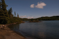
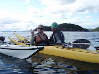
The sun rose the next morning along with the wind speed, which due to a low-pressure entrance to the area was supposed to diminish and swap around directions later in the day. It provided an opportunity to enjoy some sweet blueberry scones for breakfast and further develop our plan to search out some saunas. By early afternoon we were on the water headed for the next large island en route when we spotted two yellow kayaks; kayaks that happened to belong to our friends (Outward Bound instructors on a short break). Unfortunately while we were headed out, they were headed back, so we exchanged tales of life on the lake, they of campsites to checkout and as soon as it began we both were off on our respective journeys; them back to making a difference amongst youngsters in the woods and us finalizing the remainder of our expedition. So we headed off to experience what St. Ignace had to offer.
Offerings of challenge greeted us from our initial crossing into the maw of island life. For whatever reason, as strange phenomenon seemed to exist denoting an awkward wind direction trumping our efficient travel plans. Perhaps that is just another day in the life on the mightiest lake of them all. We made the crossing diligently, and happened to duck from the wind beyond Armour island. This area played host to some remote settlements, which were only accessible by boat. We know not whom owned such houses, garages, Direct TV® supported ‘escape’ cabins, but surely wished to have found a key and tossed logs in the fireplace as the wind wore through our paddling layers, water wetting the next to skin layers. To our dismay we were unable to locate the slightly talked about ‘Nirivia’ (apparently as it was spelled though it read Nirvana) a mystical land of bountiless smoked salmon, warm quarters for sleeping and a constantly smoldering coals for a swanky sauna… Perhaps some of that was made up in my mind, our OB friends had told us of a place and once the wind picks up my mind just happens to take it where it deems enticing. Regardless, we found no such locale. We did find a campsite with a gorgeous view of the lake, perched atop rocks a sweet place to set up shop, which is most likely exactly what the little bear who lived there thought as well. One brief encounter and allocation of bear scat-o-rino down the beach…. BOI!!! Enlightened us to move back a mile in the direction we had just paddled from. This provided an additional ‘PICSTER’ experience, setting up after dusk amidst wind, wetness and dropping temperatures. Due to the Ursus factor we dared not cook anything for fear our fatigue wouldn’t suffice sufficient energy to shake a stick at any visitors entering the campsite. Thus we had a reprise of a lunch type meal and plenty of hope tonight would yield hours of undisturbed rest.

The next morn, we arose early on to advantageously make use of the sun’s brilliance and drying power of all that is nylon. While warming up our stove decided to go on a hunger strike and we again foraged for the non-cooked meal. No matter though we would paddle on and along the southern shore of St. Ignace Island through bays, amidst islands even get a wave and hollar from fellow Canadians. Near of the Southwestern portion of the island a gargantuan Canadian flag flapped slightly in the light breeze- denoting something of interest we ventured into a protected bay to discover the Canadian acclaimed CPR slip. A marvelous piece of land donated by a Thunderbayians for the use of the people of the lake. A volunteer group had erected a main building (including two bunk beds, a table, potbellied stove, cabinets, cooking supplies journals and few metric tons of character), sauna, fire pit, fish cleaning station and a locale that seemed to be a hot hub during the summer months. Fascinating place and uplifting to see all the communal effort and pride put into it. After consuming calories we set out, sans sauna (insert sad face here) due to a positive weather window providing potential to gain some much needed ground. This, surprising as it were, would change shortly after we got on the water providing a tireless headwind to paddle into on our way to Flour Island. Making the crossing wasn’t too bad, it was the actualization that in order to make our destination would put us at risk, paddling around severely exposed shoreline with no easy exits. Once in the near shore waters of Flour we ducked into a bay and found a potential sneak through the island in some wetland looking feature. Paddling between peninsulas the wind disappeared, the trees shot towards the sky and we once again would paddle atop mirror images of ourselves. We encountered a few otters whom snorted at our presence and ended up pushing into some tall grass until it tierra firma was discovered. This solid ground surrendered a ‘return to from whence you came’ card and we meandered back out into the open channel. This time we headed south in search of potentially promising beaches. Of which on our three options we quickly struck out. There was but one GRACEFUL looking beach. SAND. Actual sand back in this rocked out landscape, but upon close inspection it contained hoof prints. We’re talking monstrous moose tracks, larger than my head. The tracks spread the entire beach somewhat erratically, mixed with some bear prints right on the water line. Although desperate weighing the pros and cons set us back on the water as neither one of are fluent enough in moose lingo to attempt and negociate the use of their area for the evening.

Back on the water we had planned to back track a few miles to an area that had looked more promising. Sluggish were the movements to make that happen and as a wildcard I decided to scope out a beach adjacent to this moose highway. As luck would have it this area, looking rough on the outside, happened to be warm and fuzzy on the inside, figuratively that is. People had camped there before. There was an old tent platform and a few flat places in the forest to set up a tent. Salvation at last! We partook in the daily ritual and soon were on the rocks cooking dinner… AWAY from camp. A swirl of energy and ambition quickly arose in the air and informed Alissa (who desperately wanted to see some Moose) “Here comes your moose.” As if we were watching a dinner theatre a massive cow trotted out into our view across the small bay (on the beach we didn’t stay on). Sprinting across the beach away from the bull that was chasing her. Right there, where we had been perhaps an hour ago, huge animals now frolicked in some clumsy courtship. She would wander in the water, hop back on the beach and the bull parade around her. Back down the beach out of view, back across the beach into view a spectical that endured for minutes. During such spectacular sights of nature it seems that my camera devotedly enjoys playing hide and seek, this time inside the kayak, opposed to at my side. I slowly got up to at least fetch the binoculars to take in the seen a little closer. This consisted of rolling out of my crazy creek chair and crawling belly down on the beach, a rock beach mind you that made precarious noises as I did so.
Unfortunately this spectacle was all it took to raise the flag of caution. (I mean someone in a blue fleece and khaki pants crawling across a grey landscape is no need to fret right?) The cow sensed danger and abruptly turned off the ‘game of hard to get’ with her partner and they both trotted off out of view. No matter, I was assured they would be back. (Yet I did not risk creating a greater noise distraction by opening and rummaging through the kayak and solely returned with the binoculars). Moments later the moose seemed to be exercising their freedom of speech ~ which in all actuality, if I were to translate it sounded a bit for like some Issac Hayes style of music- if you catch my drift. No sooner had their song ended than they romped back into our field of view apparently ‘de-tensified’ from something and waded into the water. Deeper and deeper until their torsos were cooling off, Superior style. The meandered our direction… Amazing at first, then not so amazing. They gained more and more ground until it became apparent we would have to announce our presence to not have an up close and personal stand off. We hollered, tossed rocks into the water, hooted, waved, yet this just seemed to satisfy their curiosity as they strode towards us. Finally, in my calm, collected, inside voice I mutterd a “hey moose”. A phrase the cow apparently understood, her ears perked up and head turned away. She began to trot off quickly towards the cover of the tremendous trees she and her partner only knew so well. And like that, as suddenly as it began, they were gone.

Saturday, November 1, 2008

Relaxing in Rossport?

The quaint little town which housed our food box, a kayak shop-Superior Outfitters, the famed Rossport Inn and a viable presence of the Canadian Pacific Railway, several times a day.
In our minds Rossport had become the enchanted city. A definitive tangible representation of a distance denoting we were more than half way home. (And it only took us how long to get there?) We would even paddle through a culvert to bring the small town into certain view – how cool is that? Several friends and fellow travelers along the way had recommended this town to us. And as luck would have it we would meet some friendly folks from our realm of the world (Rick and Mary from Mason, WI) while experiencing one of the most delicious (and certainly expensive) meals of our lives. This was the one locale in which we had planned to stay at an INN, momentarily relax etc. However upon settling into this triumphant town we soon realized we’d missed some details in the appreciation factor. First, there is no grocery store here; you have to travel 15 miles back in the direction from whence you came. Second, small town does not denote small prices, due to the lack of abundant amenities, be ready to pay for it. Third make sure you lay in your bed before you commit to a room, otherwise when you flop down for a good nights’ rest, you may find that the mattress has been molded for a pear shaped individual leaving your feet slightly higher than your head while your bum hangs near the floor. (Kind of like a hammock, but not). Last, is there some type of amnesia vortex in this region where everyone you talk to forgets to tell you about the TRAINS? Bring ear plugs, because as natural as they are to existence, engineers seems to have no qualms about blasting the horn several times as they pass the one crossing in town…. You know, people are pretty observant, they see the warning lights, they hear that ‘ding, ding, ding’ noise and even witness thousands of tons of metal hurdling down those steel rails at ungawdly speeds- pretty sure you could go with out that blasted horn. But I digress…

After struggling through that night of sleep, or lack there of, we regrouped at Superior Outfitters. Where owner Dave Tamblyn had been sacredly guarding our food box like a bear, ok we don’t know that for certain, but he did keep it safe and no mice got into it so that was awesome, for a few weeks. While discussing our food issues, prep packing our boats, he even offered the most unprecedented random act of kindness we’d experienced province side… The use of his vehicle (actually it was his wife’s, which is why it may have not been that big of a deal) to drive into Schreiber and purchase some buffer food. How cool was that? Way cool! We experienced velocitation for the first time since the wedding (always a fun experience when twenty minutes in the car is the equivalent of three hours on the water) and loaded up on all those important essentials for quick meals and spiffy snacks. It was also on this journey into town, the grocery store, adequately named Costa’s (cause it was gonna costa you a lot) that I almost cried. Seeing that freshie produce: avocados, tomatoes, pears, kale, garlic, peppers etc and knowing it would not last a wink and a half in the cooler was the clincher in potential Canadian blues. So close to fresh food, yet so very far away. We made haste in the store, restocked what we needed, even paid $11.22 for one pound of cheese (darned conversion of grams to pounds) and were on our way.

Back to Rossport, back to packing the boats, we set off in the late day sun towards our new appreciated and highly praised surroundings, the Rossport Islands…

Our first destination landed us upon Wilson Island, great sand beach, lots of deer tracks - we scared Bambi's relative upon arrival, and even a nice tree stand for viewing the lake, (or shooting at some food if you're into that). We then set camp, made a marvelous meal and watched the moon rise in the indigo sky.

Thursday, October 30, 2008

Searching for solitude, hoping for Rossport...

The map denoted a harbour of sorts in a bay not too far away with few islands thrown in the mix. The daunting issue was the five to six mile crossing to get there, something that would mark as a bit of a challenge should the wind return at its burly forecasted 15kts and seas at two meteres. The next morning we rose early and made a break for it, probably some of the quickest miles we’ve paddled, and entered our archipelago safe hold just as the wind was sending the waves into whitecap mode. RIGHTEOUS! We would then paddled about for the next 90 minutes searching for a place to hunker down should excrement hit the rotating oscillator. After much noggin scratching, debating and weighing of pros and cons we settled on a rock island tucked back in a little calm water refuge. Paddling back in this here bay we might as well have entered an entirely different world. The wind fought diligently to touch us, but the topography and islands shielded us well. The passages between these islands were much smaller and more boundary water like than Lake Superior. I can’t really think of a time thus far where we have camped upon one solid island of rock surrounded by dense forest lined with a floor of sphagnum moss. This solid ground would serve as home for the next three days as the winds decided to ‘step it up a notch’ into the 20kt range from the south west, (largest fetch we could possibly have) then the west (forward momentum deterrent), northwest (somewhere between probable travel and shopping day) and finally east (triumphant escape). At one point we did try to make a break for it, paddled out in the five foot swells (no wind) only to find no tangible refuge, the daylight waning and reality of landing in big surf not so high on the ‘smart things to do’ list. We returned to the isle, re-set up camp and made the best of it, realizing it could be worse. That night after losing the last of our water weight Alissa denoted a display of shifting colours in the sky. Without clouds or light pollution we witnessed a most delectable display of northern lights. One of those moments you just have to experience to truly appreciate.

During our days on the island helicopters continually flew overhead. Generally the same one, and we could only imagine what they thought of us.
**Radio banter…. Helicopter Noises**
“Uh, Chuck do you see what I see?”
“ That’s a big ten fore Robby. Bunch of trees eh?”
“Negative moron. Paddlers, down on that island.”
“Ohhh right. Affirmative. The obviously didn’t get the memo from that local Canadian who knows these parts well. Over.”
“Roger that. Yeah, then they would have known the wind comes from the South. All of it, all of the time.”
“Affirmative on your, Roger that.”
“Uh, Chuck, do you don’t have to say, ‘Affirmative on your Roger’- Just Roger will do, eh?”
“Roger that, Robby.”
“Let’s go to Tim Horton’s™.”
“Support on Tim Horton’s™. Over and out.”
**Doppler effect of helicopter noise diminishing.**

Had we made it to day four on the island we certainly would have constructed a sign which read ‘doughnuts please’. As we’ve learned to not over stay our welcome, and that three is the magic number, we ducked off the isle on day four of its presence and paddled, paddled paddled towards Rossport. That day we would cover a multitude of shoreline taking us by some columnar jointing which seemed to have toppled over providing a unique view. We would see the infamous Slate Islands and paddle by Terrace Bay, which some folks use to gain their admission to this abundant caribou environment. That evening we came upon a beauteous beach with some make shift shelter looking thing, maintained by some hiking club. Figuring folks wouldn’t be out romping about at this hour we settled it down into our home and enjoyed a spectacular sunset after a sub 30-mile day. (Pretty rocking when you can cover in one day what you struggled through in the three previous (before the wind bound-age)). The next morning we would be at it again, hammering the miles away and paddling into our intended destination of Rossport.

En route we continued to explore some intriguing geological formations further deepening our understanding of the natural history in this stretch. This section also takes you along the Kings highway an experience that can be trying at times, facing the experience on the lake (which at this point happened to be in the wind) against those folks traveling self-contained in their motor vehicles. Quite close, yet far enough away to continue to stay removed from each other’s existence, a honk and wave the only momentarily connection exchanged between worlds.

Wednesday, October 29, 2008

Movin on from Marathon

JUST KIDDING. Wanted to make sure you were still reading, ha! We did wander up into Marathon, which happened to, dare I say, seem like a bleak town. Not once did we run into someone who smiled. There was an interesting energy about the place and perhaps we just stuck out enough to not fire the ‘friendly synapse’ in the folks we met. We happened to stock up upon some essential foods; assuming we would be able to make it to Rossport, our next stop, in four days time. (Little did we actualize, this was the PRIME time to have those Nostradamus skills.) We had put the positive energy out there that would warrant this leg of the journey to flow smoother than the previous ten days to cover 122 miles. (Three or four of which were weather days). Until that point I had felt pretty good about our food selection, we planned, and prepared ourselves to eat boxed food- which in our neck of the woods came from a natural food section, meaning our boxed food, was not necessarily unhealthy. Buying ‘boxed food’ elsewhere enacted me to feel like Edward Abbey’s character Hayduke, enforcing me to mumble ‘chemicals, chemicals, chemicals….’ As we ate our meals over the following few weeks… Back at the boats, repacked and jonesing to go, a fellow Canadian, one whom knew these parts offered us some fish, unfortunately packed to the gills ourselves and not owning a fillet knife, (let alone possessing the knowledge of what to do with one) we gracefully declined. He told us of some camping places and informed us that the wind, “ALL OF IT ALL THE TIME, would now be from the South – good luck.” This of course would make perfect hypothetical sense as we were now on the north shore… Que Sera, Sera.

We camped on some swank sand abode facing Detention island, (little foreshadowing there) hoping tomorrow would be a more prosperous day. Yielding no such return we fought 4-6 foot beam (from the side) swells and 15 knot winds during our just under five mile crossing. Slightly gripped from that experience we hung out on Detention isle until later in the afternoon and made a break for it, still swells, but no wind, warranted our arrival to Pic Island just after sunset, where we would literally almost camp on the water. This would be a defining corner stone of the journey, gentle rolling swells up no wind until we reached the Pic-ster right as the sun was going down some blast of 10+ knot wind ripping over the isle into our faces giving that early evening chill. (We would later refer to late-day decisions with reference, ‘We don’t want o have another Pic Island experience do we? Thus recollecting a dark , wet, cold, windy creation of camp.) No worries though the next day would yield an early start. Banking on the pattern of the winds we should be able to at least make it to the provincial park before it kicked up. (Insert laughter here) How wishful we were in our thinking. By the time we rose, our reference buoys were registering some heavy wind from the southeast, no need for alarm though we were in the wind shadow from the island. We paddled out and positioned for the 1.5 mile crossing no big deal right? Except the wind was wrapping around the island causing the waves to crash over you one way while the wind pushed you another, exciting times. We fought through that only to never find the boat launch for the campground and got pressed deeper into this bay yielding no real safe ground to land. At one point we saw a small fishing boat, and I mean small, like the one Uncle Bob uses to catch bass on the weekend with his buddies, all of us thinking the same thing, “What the heck!?” Shortly after that a miraculous saving grace appeared in the form of a sail boat moored, unattended with a note that read ‘ If you’ve found this boat, it’s yours to keep for free… Really! There are instructions how to sail located in the cabin…’ ok so that didn’t happen, but we did stumble, upon a sandy beach with, bum bah daah baaaahhh…. A CAMPSITE!! A few of them actually. SWEET. Protected from the wind we watched the waves build and break all day and attempt to plot our route whilst staying warm in the sunshine.